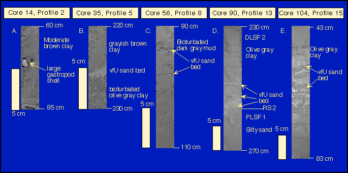
Grayscale digital photographs of the variability observed in the marine to distal lower shoreface facies. Photos A and B illustrate marine facies and C-E illustrate distal lower shoreface facies.
Near-shore core dataset
Evolution of the Central Texas shoreface
Central Texas versus East Texas
shoreface preservation potential
Offshore dataset
Highstand systems tract
Lowstand systems tract
Transgressive systems tract
Controlling factors on shoreline configuration