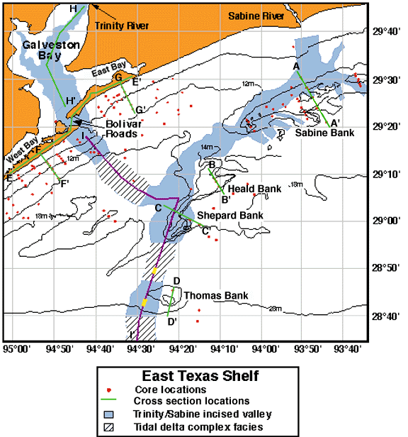
East Texas (Sabine/Trinity/San Jacinto)
Transgressive Systems Tract


During the early stages of the transgression, a prominent shelf margin delta was constructed on the shelf west of the Trinity/Sabine/Brazos incised valley. Platform borings indicate that the delta is comprised of mud and radiocarbon ages from the delta indicate that it was active until approximately 14,000 years ago, long after the outer shelf was flooded.

The following is a bathymetric map of the east Texas shelf showing the locations of seismic lines, cores, and cross-sections. The Trinity/Sabine incised river valley (blue) and tidal inlet deposits (striped) preserved within it are also shown. Cross-section and seismic lines are clickable, as well as text shown on the map.


A-A': Sabine Bank
B-B': Heald Bank
C-C': Shepard Bank
D-D': Thomas Bank
F-F': Offshore Galveston Island
G-G': Offshore Bolivar Island
H-H': Galveston Bay
I-I': cross section of Trinity incised valley
example of an interfluvial core
Bolivar Roads: modern complex
Sabine Bay: Sabine Lake
Trinity incised valley: tidal deposits


Gulf Bottom Imagemap


Comments, questions? Contact us at gulf@gulf.rice.edu.