LOWSTAND SYSTEMS TRACT
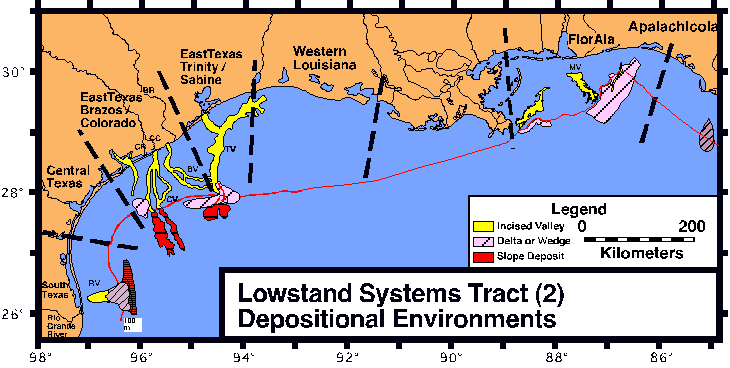
Over 20,000 km of high-resolution seismic data (40-20000 Hz) and hundreds of platform boring descriptions and samples have been analyzed in the northern Gulf of Mexico (offshore Texas, Louisiana, Alabama, and Florida) to reconstruct the depositional environments during the most recent lowstand in sea level. The lowstand units are interpreted to lie between the oxygen isotope Stage 2 sequence boundary (approximately 18,000 yr BP) and the oxygen isotope Stage 2 to 1 transgressive surface.
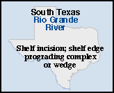
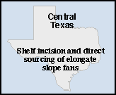
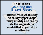
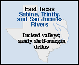
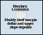
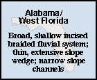
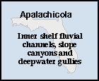
Our study demonstrates a large amount of lateral variability in lowstand depositional environments and corresponding deposits in the northern Gulf of Mexico. The deposits include sand-dominated and mud-dominated prograding complexes, wedges, and thin units characterized by periods of erosion and nondeposition. Sediments vary in thickness from 75 m thick delta lobes offshore east and south Texas to thin mud drapes of negligible thickness off the central Texas shelf.
The variability in the lowstand depositional environments appears to be controlled by sediment supply, shelf gradient and width, and tectonics. Understanding the contributions of different combinations of controlling factors in the various lowstand depositional environments along the northern Gulf of Mexico, allows the development of depositional models to predict lowstand reservoir character and distribution in ancient strata.
Paleogeographic map of lowstand depositional environments in the Gulf of Mexico

Comments, questions? Contact us at
gulf@gulf.rice.edu.