The Brazos River leads all Texas rivers in rates of flow. Its watershed encompasses 118,000 square kilometers and includes large sections of north-central Texas and eastern New Mexico. The average annual suspended-sediment yield of the Brazos is the highest of all rivers in Texas, 39 metric tons per square kilometer (Curtis et al. 1973). The sediments of the Brazos River have a distinctive red color and are characterized by fine grain sizes; most of the sediment load is of clay-size. These sediments are derived primarily from Triassic red beds located in the upper reaches of the drainage basin in northwestern Texas and northeastern New Mexico.
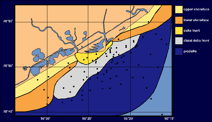
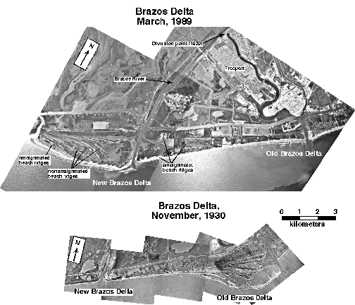
The Brazos Delta is located immediately southwest of Freeport, Texas at coordinates 28 52'N and 095 23'W. It is approximately 35 km2 in area and extends seaward to water depths of 20 meters. The delta has formed since 1929, when the Brazos River was diverted by the U.S. Corps of Engineers in an effort to reduce flooding and shoaling at Freeport. The 1930 delta photo below was taken shortly after river diversion and depicts the early stage of delta reworking. A significant amount of sediment was eroded from the old delta and deposited at the new delta following river diversion.
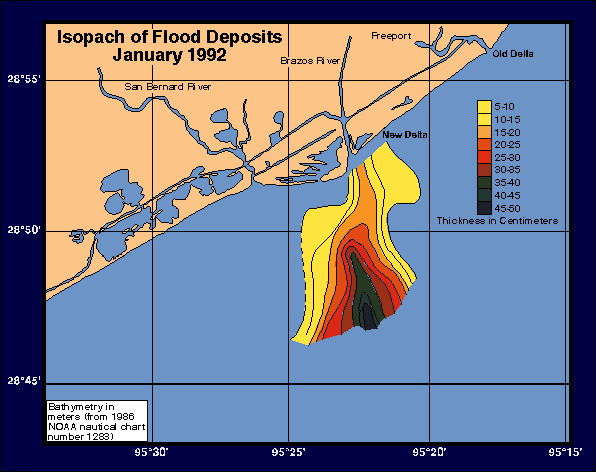
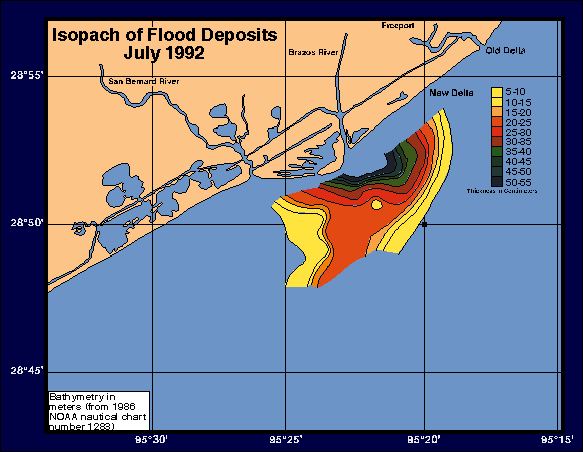
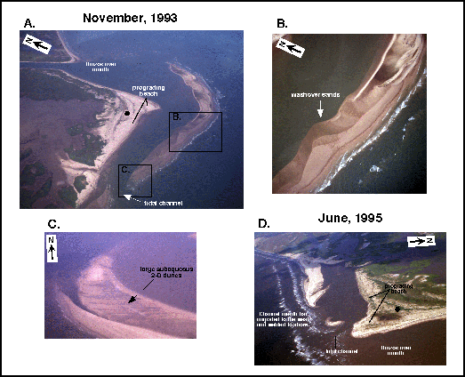
The Brazos Delta contains an excellent record of floods events. During the most recent 1992 flood, the Brazos River was at flood stage for approximately 80 days (photos). During this event the prodelta experienced up to 50 cm of vertical accumulation in some places (isopach map). The flood deposit was later reworked to the northwest by waves (isopach map). Flood events are preserved in the prodelta as layers of red clay (core photo). The delta front environment encompasses the area just seaward of the river mouth and beach. This environment changes dramatically after floods. As a result of flood deposits being reworked landward the delta-front environment expands and the channel mouth bar emerges, enabling formaton of a back-bar lagoon. This emergent bar is subsequently reworked by waves and migrates landward forming a new shoreline, preserving the pre-flood shoreline and back-bar lagoon as a ridge/trough pair within the western delta headland. Eight months after the 1992 flood was the last episode of channel mouth bar emergence (Hamilton, 1995).
For greater detail on the sedimentary forces of the modern Brazos Delta, see Rodriguez, A., Anderson, J.B., and Hamilton, M., 2000, Evolution and facies architecture of the modern Brazos Delta, Texas: Journal of Sedimentary Research, V. 70, p. 283-295.