Central Texas offshore dataset
The offshore dataset consists of 1200 km of 2-D seismic data and 68 platform
boring descriptions. Preliminary interpretations of the seismic dataset were performed by
Eckles (1996) and Eckels et al (2004). She mapped the gross depositional environments during the highstand and
transgressive systems tracts. The map below shows the depositional environment map of
Stage 5e from Eckles (1996) and Eckels et al (2004).
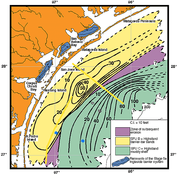
Eckles (1996) found that prograding shorelines occurred within the highstand systems
tract. The sand-prone shorelines prograded to mid-shelf with coeval mud-prone deposits
offshore.
The current study focuses on a detailed reconstruction of deposition from Stage 5e
to present (the last glacial eustatic cycle) incorporating additional platform boring
descriptions as well as seismic a lithologic ties to east and south Texas datasets. Deposition
offshore central Texas occurred during the highstand systems tract, lowstand systems
tract, and the transgressive systems
tract.
Near-shore
core dataset
- Evolution
of the Central Texas shoreface
-
- Central
Texas versus East Texas shoreface preservation
potential
Offshore
dataset
- Highstand
systems tract
- Lowstand
systems tract
- Transgressive
systems tract
Controlling
factors on shoreline configuration