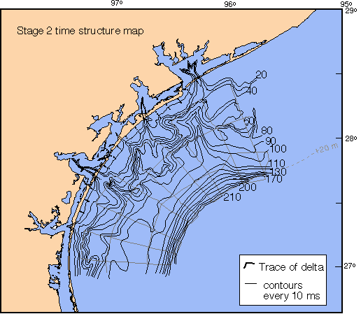
The Stage 2 time structure map was constructed using Stage 2 fluvial incision depths from Wright (1980), who mapped this surface in bays of central Texas, from the near-shore core dataset, and the shelf dataset. Fluvial incision and valley fill characteristics are shown in cross-section 1 and seismic line 42.
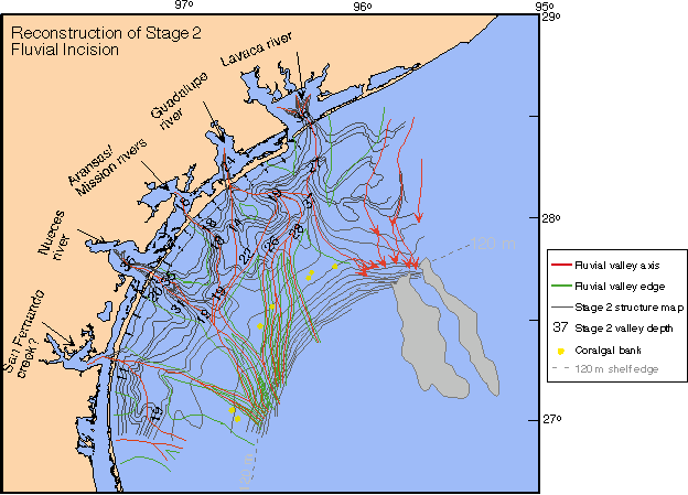
Stage 2 fluvial valleys are superimposed on the Stage 2 time structure map. Valley depths decrease offshore in the western portion of the study area. These valleys bifurcate, shallow, and become narrower channels offshore. In the east, valley depths increase offshore. The Lavaca/Guadalupe river and the Colorado River Stage 2 valley bifurcated, shallowing to -26 meters, 60 km offshore. These fluvial sediments likely bypassed the shelf, feeding the lowstand slope fans. Two elongate fans existed on the upper slope during the Stage 2 lowstand. One of the these fans was sourced from the sand-prone Stage 3 delta mouth bar and, therefore, contains significant sand (based on Eureka cores through the fan). The other fan was sourced from prodelta clays and contains little or no sand. These fans are virtually identical in terms of seismic character.
Near-shore core dataset