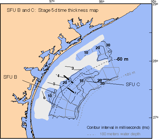
Time thickness map of SFU B from the amalgamated Stage 5e/5d surface to the Stage 5c surface. The gray area represents erosion and removal of Stage 5c deposits by Stage 2 fluvial incision. Seismic line 9 shows sand-prone SFU B as well as downlapping reflectors onto the 5e/d downlap surface. Seismic line 11 shows the coeval mud-prone deposit offshore. Platform boring cross-sections 3, 4, 5, and 6 show the lithologic characteristics of SFU B and SFU C.
The depositional environments of the Stage 5d shoreline are shown below.
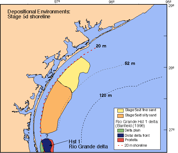
Depositional environments of the Stage 5d shoreline. Thick, extensive Stage 5d sands were deposited on the central Texas shelf, primarily from the longshore transport of delta front sands from the ancestral Rio Grande HST 1 delta.
Highstand Stage 3:
Deposition during Stage 3 is shown below.
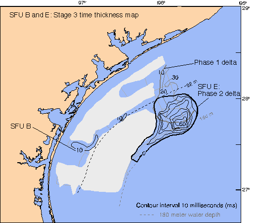
Time thickness map of SFU B from the Stage 2 SB to the Stage 3 maximum flooding surface. Gray areas represent erosion of SFU B by Stage 2 fluvial incision. Seismic line 9 and cross- section 4 show how Stage 3 SFU B thin to mid-shelf. The two thicks located in the east are two phases of deltaic development. Phase 1 is the early Stage 3 Colorado delta mapped by Snow (1998) and the Phase 2 is the late Stage 3 Colorado/Lavaca/Guadalupe delta mapped in this study. Seismic dip line 1b shows the oblique progradational reflectors of the delta. Strike line 20 shows the two lobes of the delta - the western lobe is sourced from the Lavaca/Guadalupe rivers and the eastern lobe is sourced from the Colorado River.
Stage 3 depositional environments
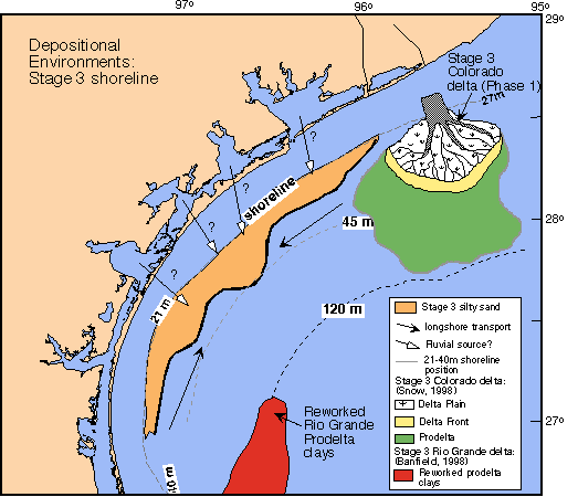
Depositional environments across the east to south Texas shelves during Stage 3. The ancestral Colorado and Rio Grande rivers deposited fluvial-dominated deltas. Deltaic sands were likely transported along-shore toward the central Texas shelf. Three protuberances in the central Texas shoreline indicate fluvial deposition may have been responsible for greater progradation in these locations.
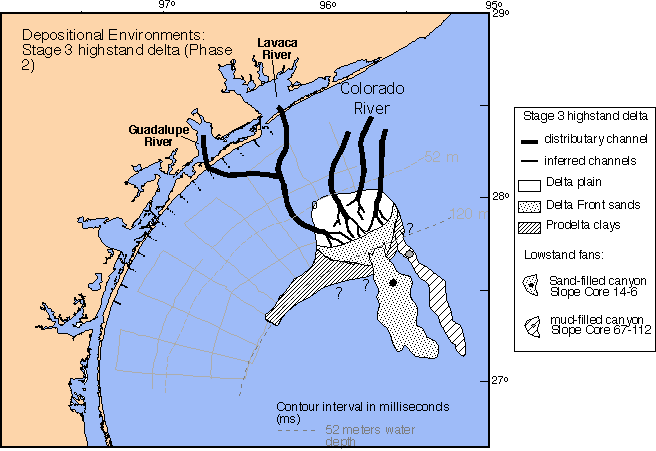
Depositional environments of the shelf-edge highstand delta. The delta is composed of delta plain, delta front, and prodelta sediments and was sourced from the ancestral Colorado and Lavaca/Guadalupe rivers. Platform boring cross-section 2 shows the lower sand unit of the highstand delta. Two lowstand slope canyons (East Breaks Slides) are shown. The western canyon is sand-filled and was sourced from the delta front. The eastern canyon is mud-filled and was sourced from the prodelta.
Near-shore core dataset
