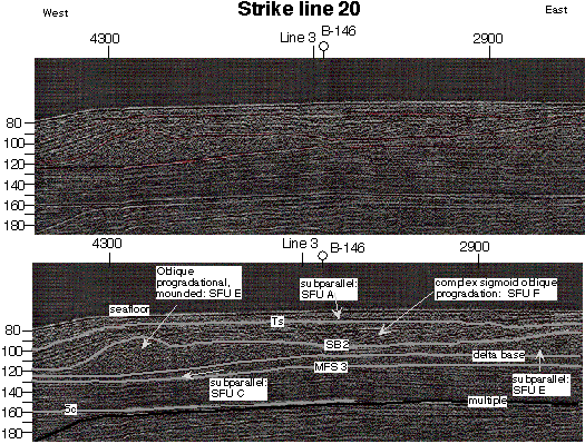
Seismic Line 20 illustrates the major seismic surfaces and seismic facies of the central Texas shelf. MFS3=Stage 3 maximum flooding surface, SB2= Stage 2 sequence boundary and TS=transgressive surface.
Near-shore
core dataset
- Evolution
of the Central Texas shoreface
-
- Central
Texas versus East Texas shoreface preservation
potential
Offshore
dataset
- Highstand
systems tract
- Lowstand
systems tract
- Transgressive
systems tract
Controlling
factors on shoreline configuration